English
 norsk
norskBlar i forfatter "Vorren, Tore Ola"
Viser treff 1-8 av 8
-
Formation of a large submarine crack during the final stage of retrogressive mass wasting on the continental slope offshore northern Norway
(Journal article; Tidsskriftartikkel; Peer reviewed, 2013-08-30)High-resolution swath-bathymetry data integrated with sub-bottom profiles and single-channel seismics reveal an 18 km long, up to 1000 m wide and 10-15 m deep crack located approx. 4 km upslope from a slide scar on the continental slope off northern Norway. This crack is formed by subsidence of the sea-floor sediments to a depth of 120 m due to downslope movement of a ~80 km2 large sediment slab ... -
Gamle olje- og gass-lekkasjer i Barentshavet
(Chronicle; Kronikk, 2010-08-28) -
Late Cenozoic development of the continental margin off Lofoten-Vesterålen and Troms
(Conference object; Konferansebidrag, 2011) -
Late Pliocene–early Pleistocene deep-sea basin sedimentation at high-latitudes: mega-scale submarine slides of the north-western Barents Sea margin prior to the shelf-edge glaciations
(Journal article; Tidsskriftartikkel; Peer reviewed, 2015-10-01)At high‐latitude continental margins, large‐scale submarine sliding has been an important process for deep‐sea sediment transfer during glacial and interglacial periods. Little is, however, known about the importance of this process prior to the arrival of the ice sheet on the continental shelf. Based on new two‐dimensional seismic data from the NW Barents Sea continental margin, this study documents ... -
The marine-based NW Fennoscandian ice sheet: glacial and deglacial dynamics as reconstructed from submarine landforms
(Journal article; Tidsskriftartikkel; Peer reviewed, 2013-03-16)The configuration of the marine-based NW Fennoscandian ice sheet during the Last Glacial Maximum (LGM) and deglaciation is reconstructed using detailed swath bathymetry and high-resolution seismic data. The investigated area covers about 10,000 km<sup>2</sup> of the continental shelf off Troms, northern Norway. Large scale morphology is characterized by cross-shelf troughs, coast-parallel troughs ... -
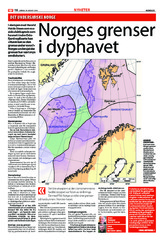
Norges grenser i dyphavet
(Chronicle; Kronikk, 2010-08-14) -
Undersjøiske daler og oljereservoar
(Chronicle; Kronikk, 2010-10-02) -
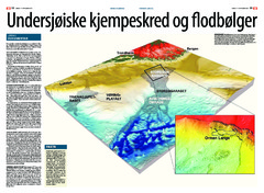
Undersjøiske kjempeskred og flodbølger
(Chronicle; Kronikk, 2010-09-25)